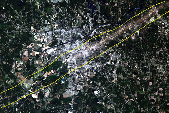
When the devastating EF4 tornado ripped through Tuscaloosa five years ago, it left a 7.5 mile long path of destruction in its wake. Rosedale, University Place, Forest Lake, Cedar Crest, Wood Square/City Center, and Alberta City were some of the most heavily impacted areas, but in five years Tuscaloosa is on the rebound. The following images were captured via satellite remote sensing over the course of seven years, and they showcase how Tuscaloosa is not only recovering but growing. “Although […]
Tuscaloosa Five Years after the Storm